How Airbus CO3D’s AI-Driven, Laser-Linked Satellite Constellation is Transforming High-Resolution 3D Mapping Worldwide
- Market Overview
- Emerging Technology Trends
- Competitive Landscape Analysis
- Growth Forecasts and Projections
- Regional Market Analysis
- Future Outlook and Strategic Directions
- Key Challenges and Opportunities
- Sources & References
“Russian satellites 'Elektro-L' and 'Arktika-M' provided high-resolution images of Cyclone Ziros over Moscow.” (source)
Market Overview
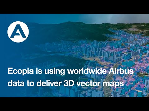
The Airbus CO3D (Constellation Optique 3D) project represents a significant leap in Earth observation capabilities, leveraging artificial intelligence and advanced laser communication to deliver high-resolution, global 3D mapping. The constellation, developed by Airbus Defence and Space, is designed to provide 50 cm resolution stereo imagery, enabling the creation of detailed digital surface models (DSMs) and digital terrain models (DTMs) for a wide range of applications, including urban planning, environmental monitoring, and defense.
Launched in 2024, the initial four-satellite CO3D constellation operates in sun-synchronous orbit, ensuring consistent lighting conditions for imaging. Each satellite is equipped with high-performance optical sensors and is capable of capturing up to 1 million km² of stereo imagery per day. The system’s AI-powered processing chain automates the transformation of raw imagery into precise 3D models, significantly reducing turnaround time from data acquisition to delivery (Airbus Press Release).
- Resolution and Coverage: CO3D delivers 50 cm ground sample distance (GSD) in panchromatic mode, with a daily revisit capability, making it one of the most advanced commercial 3D mapping solutions available (Airbus CO3D Product Page).
- AI Integration: The constellation’s onboard and ground-based AI algorithms streamline image processing, automate feature extraction, and enhance the accuracy of 3D reconstructions, supporting rapid decision-making for end users.
- Laser Communication: CO3D satellites utilize optical inter-satellite links (OISL) for high-speed, secure data transfer, reducing latency and increasing the volume of data delivered to ground stations (Space.com).
- Market Position: Airbus positions CO3D as a complement to its existing Pléiades Neo constellation, targeting government, commercial, and scientific markets seeking high-frequency, high-precision 3D geospatial data.
The global geospatial analytics market is projected to reach $134.5 billion by 2030, growing at a CAGR of 12.6% (MarketsandMarkets). With its unique combination of AI, laser communication, and high-resolution 3D mapping, CO3D is poised to capture a significant share of this expanding market, offering unprecedented capabilities for real-time, global geospatial intelligence.
Emerging Technology Trends
The Airbus CO3D (Constellation Optique 3D) project represents a significant leap in Earth observation technology, leveraging artificial intelligence and advanced laser communication to deliver high-resolution, global 3D mapping. Launched in 2024, the CO3D constellation consists of four identical satellites, each equipped with state-of-the-art optical sensors capable of capturing imagery at a 50 cm ground sampling distance (Airbus).
One of the defining features of CO3D is its integration of AI-powered onboard processing. This allows the satellites to autonomously select, process, and compress the most relevant data before downlink, significantly reducing latency and bandwidth requirements. The constellation is also among the first to employ inter-satellite laser links, enabling rapid data transfer between satellites and to ground stations, which further accelerates the delivery of 3D mapping products (SpaceNews).
Key capabilities and trends associated with Airbus CO3D include:
- High-Resolution 3D Mapping: The 50 cm resolution enables detailed analysis for urban planning, agriculture, disaster response, and environmental monitoring.
- Rapid Global Coverage: The constellation can map the entire landmass of the Earth in 12 months, providing up-to-date 3D models for commercial and governmental users (Geospatial World).
- AI-Driven Data Processing: Onboard AI reduces the need for ground-based processing, enabling near real-time delivery of actionable insights.
- Laser Communication: Optical inter-satellite links support high-speed, secure data transfer, a trend increasingly adopted in next-generation satellite constellations.
- Commercial Accessibility: Airbus plans to make CO3D data available through its OneAtlas platform, democratizing access to high-quality 3D geospatial information (OneAtlas).
The CO3D initiative exemplifies the convergence of AI, advanced optics, and laser communications in the Earth observation sector. As demand for precise, timely geospatial data grows across industries, Airbus CO3D is poised to set new standards for global 3D mapping, supporting applications from smart cities to climate resilience.
Competitive Landscape Analysis
The competitive landscape for high-resolution, AI-powered Earth observation is rapidly evolving, with Airbus’s CO3D constellation emerging as a significant player. CO3D (Constellation Optique 3D) is a joint initiative between Airbus Defence and Space and the French National Centre for Space Studies (CNES), aiming to deliver global 3D mapping at 50 cm resolution. The constellation, comprising four identical satellites, leverages advanced AI algorithms and inter-satellite laser links to provide near-real-time, high-precision 3D data (Airbus).
CO3D’s main competitors include:
- Maxar Technologies: Maxar’s WorldView constellation offers up to 30 cm resolution imagery and robust 3D mapping capabilities. Maxar’s 3D Surface Model and Precision3D products are widely used in defense, urban planning, and mapping (Maxar).
- Planet Labs: While Planet’s Dove and SkySat fleets focus on high-frequency, medium-to-high resolution imaging (up to 50 cm with SkySat), their 3D mapping is less advanced than CO3D’s dedicated stereo capabilities (Planet).
- ICEYE: Specializing in synthetic aperture radar (SAR), ICEYE provides all-weather, day-night imaging, but at lower spatial resolution for 3D mapping compared to optical constellations like CO3D (ICEYE).
- BlackSky and Satellogic: Both offer high-revisit, sub-meter optical imagery, but their 3D mapping capabilities and AI integration are less mature than Airbus’s CO3D (BlackSky, Satellogic).
CO3D’s unique value proposition lies in its combination of 50 cm native stereo imaging, AI-powered processing, and laser inter-satellite links for rapid data delivery. This positions Airbus to serve demanding markets such as defense, infrastructure, and environmental monitoring, where both accuracy and timeliness are critical. The global 3D geospatial market is projected to reach $16.2 billion by 2028, growing at a CAGR of 15.2% (MarketsandMarkets), underscoring the strategic importance of CO3D’s capabilities in the competitive landscape.
Growth Forecasts and Projections
The Airbus CO3D constellation represents a significant leap in Earth observation capabilities, leveraging artificial intelligence and advanced laser communication to deliver high-resolution, global 3D mapping. Launched in 2024, the CO3D (Constellation Optique 3D) system comprises four identical satellites, each equipped with state-of-the-art optical sensors capable of capturing imagery at 50 cm resolution. This enables the generation of detailed, three-dimensional maps of the planet’s surface, supporting applications in urban planning, agriculture, disaster response, and environmental monitoring.
Market analysts project robust growth for the global geospatial analytics market, driven in part by innovations like CO3D. According to MarketsandMarkets, the geospatial analytics market is expected to grow from $78.5 billion in 2023 to $150.7 billion by 2028, at a CAGR of 13.8%. The demand for high-resolution, frequently updated 3D data is a key driver, as industries and governments seek more precise insights for decision-making.
CO3D’s integration of AI for onboard data processing and its use of laser links for rapid data downlink set it apart from traditional Earth observation systems. These features enable near-real-time delivery of 3D mapping products, reducing latency and increasing the value of the data for time-sensitive applications. Airbus anticipates that the constellation will produce up to 500,000 km² of 3D data per day, with global coverage achievable within a few months (Airbus).
- Commercial Demand: Sectors such as insurance, infrastructure, and natural resources are expected to be major adopters of CO3D data, seeking to leverage its accuracy and timeliness for risk assessment and asset management.
- Government Applications: National mapping agencies and defense organizations are projected to increase spending on 3D geospatial data, with CO3D positioned as a leading provider.
- Competitive Landscape: While competitors like Maxar and Planet Labs offer high-resolution imagery, CO3D’s unique combination of 3D mapping, AI, and laser communications is anticipated to capture significant market share.
In summary, the Airbus CO3D constellation is poised to accelerate the growth of the global 3D mapping market, with forecasts indicating strong demand and rapid adoption across multiple sectors. Its technological advancements are expected to set new industry standards for resolution, speed, and data accessibility.
Regional Market Analysis
The Airbus CO3D constellation represents a significant leap in Earth observation capabilities, leveraging artificial intelligence (AI) and advanced laser communication to deliver global 3D mapping at an unprecedented 50 cm resolution. Launched in 2024, the CO3D (Constellation Optique 3D) system comprises four identical satellites, each equipped with high-resolution optical sensors and onboard AI processors. This enables near real-time data processing and rapid delivery of 3D geospatial products to commercial and governmental clients worldwide (Airbus).
Regional Market Penetration and Demand Drivers
- Europe: The European market, led by the EU’s Copernicus program and national geospatial agencies, is a primary adopter of high-resolution 3D mapping for urban planning, infrastructure monitoring, and environmental management. Airbus, headquartered in France, benefits from strong regional partnerships and regulatory support, positioning CO3D as a preferred solution for public and private sector projects (Copernicus).
- North America: The U.S. and Canada represent a robust market, driven by defense, disaster response, and smart city initiatives. The demand for rapid, high-accuracy 3D data is accelerating, with CO3D’s AI-powered analytics and secure laser data links offering a competitive edge over legacy systems (Geospatial World).
- Asia-Pacific: Rapid urbanization and infrastructure development in China, India, and Southeast Asia are fueling demand for detailed 3D mapping. Airbus has expanded its regional presence through partnerships and data distribution agreements, targeting government and commercial sectors seeking advanced geospatial intelligence (Airbus CO3D).
- Middle East & Africa: The need for resource management, urban expansion, and security applications is driving adoption. While market maturity varies, pilot projects and collaborations with local agencies are increasing CO3D’s footprint.
Competitive Landscape and Outlook
CO3D faces competition from Maxar’s WorldView Legion and Planet Labs’ SkySat, but its unique combination of 50 cm resolution, AI-driven processing, and laser-based data transfer positions it as a technological leader. The global 3D mapping market is projected to reach $7.6 billion by 2028, with a CAGR of 15.2% (MarketsandMarkets). Regional adoption will be shaped by data sovereignty regulations, infrastructure investments, and the growing need for real-time, actionable geospatial intelligence.
Future Outlook and Strategic Directions
The Airbus CO3D (Constellation Optique 3D) project represents a significant leap in Earth observation, aiming to deliver global 3D mapping at 50 cm resolution. This constellation, comprising four identical satellites, leverages artificial intelligence (AI) and laser communication links to provide near-real-time, high-precision geospatial data. As the demand for detailed, up-to-date 3D mapping grows across sectors such as urban planning, agriculture, defense, and disaster management, CO3D is strategically positioned to address these needs with unprecedented efficiency and accuracy.
Future Outlook
- Market Growth: The global geospatial analytics market is projected to reach $209.6 billion by 2030, growing at a CAGR of 12.6% (MarketsandMarkets). High-resolution 3D mapping is a key driver, with increasing adoption in smart cities, infrastructure monitoring, and environmental management.
- Technological Advancements: CO3D’s integration of AI enables automated image processing, object detection, and change analysis, reducing turnaround times and operational costs. The use of laser inter-satellite links ensures rapid data transfer, supporting near-real-time delivery (Airbus).
- Strategic Partnerships: Airbus collaborates with the French National Centre for Space Studies (CNES) and leverages its Pléiades Neo infrastructure, enhancing data fusion and analytics capabilities (CNES).
- Commercialization: The constellation is expected to serve both governmental and commercial clients, with applications ranging from precision agriculture to autonomous vehicle navigation. The ability to update global 3D maps every few months offers a competitive edge over traditional mapping solutions.
Strategic Directions
- Expansion of Constellation: Airbus may scale the CO3D constellation to increase revisit frequency and coverage, responding to market demand for higher temporal resolution.
- AI-Driven Services: Continued investment in AI will enable advanced analytics, such as predictive modeling and automated anomaly detection, creating new value-added services.
- Integration with Other Data Sources: Combining CO3D data with radar, hyperspectral, and IoT sources will enhance multi-dimensional insights for clients.
- Global Partnerships: Airbus is likely to pursue further collaborations with international agencies and private sector players to expand its market reach and technological capabilities.
In summary, Airbus CO3D’s AI-powered, laser-linked constellation is set to redefine global 3D mapping, offering scalable, high-resolution solutions that align with the evolving needs of the geospatial market.
Key Challenges and Opportunities
The Airbus CO3D constellation represents a significant leap in Earth observation, aiming to deliver global 3D mapping at 50 cm resolution. This ambitious project leverages artificial intelligence (AI) and laser communication links to enhance data acquisition and transmission. However, the initiative faces several key challenges while also presenting notable opportunities for the geospatial and satellite industries.
-
Challenges:
- Data Volume and Processing: The CO3D constellation is expected to generate petabytes of high-resolution imagery annually. Managing, storing, and processing this data in near real-time requires robust AI algorithms and scalable cloud infrastructure. Ensuring data integrity and minimizing latency are ongoing technical hurdles (Airbus Press Release).
- Laser Communication Integration: While laser links promise faster, more secure data transfer compared to traditional radio frequency systems, they are susceptible to atmospheric interference and require precise alignment. Developing reliable, weather-resilient optical communication remains a complex engineering challenge (SpaceNews).
- Regulatory and Security Concerns: High-resolution global mapping raises privacy and security issues, especially as data becomes more accessible. Navigating international regulations and ensuring compliance with data protection laws is critical for market adoption (Geospatial World).
-
Opportunities:
- Commercial and Government Applications: The 50 cm 3D mapping capability opens new markets in urban planning, agriculture, disaster response, and defense. Governments and enterprises can leverage this data for more accurate modeling, monitoring, and decision-making (Airbus CO3D Overview).
- AI-Driven Insights: Integrating AI for automated feature extraction and change detection accelerates the delivery of actionable intelligence, reducing manual analysis time and enabling scalable geospatial analytics (Satellite Today).
- Enhanced Data Accessibility: Laser-linked satellites can transmit large datasets rapidly, supporting near real-time applications and fostering innovation in downstream services such as smart cities and autonomous navigation.
In summary, while Airbus CO3D faces technical and regulatory challenges, its AI-powered, laser-linked constellation is poised to transform global 3D mapping, unlocking substantial commercial and societal value.
Sources & References
- Airbus CO3D: AI-Powered, Laser-Linked Constellation for 50 cm Global 3D Mapping
- Airbus CO3D Overview
- Space.com
- MarketsandMarkets
- SpaceNews
- Geospatial World
- OneAtlas
- Maxar
- Planet
- ICEYE
- Satellogic
- Copernicus
- Satellite Today